Forums › Forums › Public High Lakes Forum › High lakes discussion › Dome & Spire Climb 1962:
- This topic has 7 replies, 6 voices, and was last updated 11 years, 5 months ago by
John Corallo.
-
AuthorPosts
-
-
January 10, 2006 at 6:36 am #81383
Anonymous
Mike and Don’s climb up Dome and Spire…Trail Blazer history 1962.
enjoy,http://www.alpinequest.com/domeand.htm
McPil
-
January 21, 2015 at 2:54 pm #85460
Mr. Curtis,
Can you lend a hand in getting this link to open? Love to read these old reports.
Mr. C
-
January 24, 2015 at 3:53 am #85458
Hey Johnny – did you try typing The web address into your browser? If that doesn’t work Ken might have taken his web site down
-
January 24, 2015 at 5:46 pm #85459
This from Mike Swayne Journals in TB’er annual s in members only section.
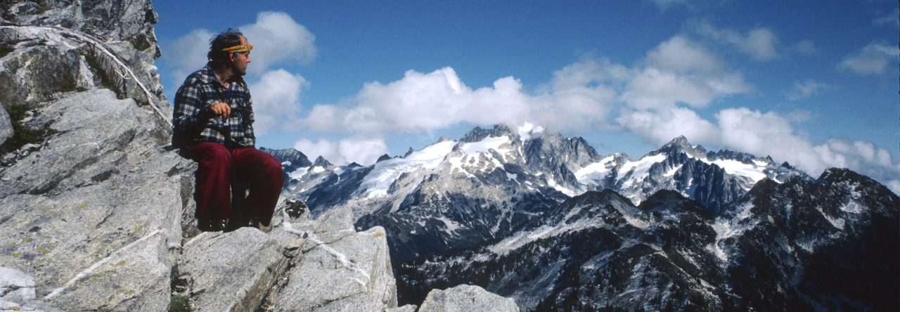
Dome, Spire and Spinster Peaks, Mule and Spire Lakes July 25-28, 1962.
Don Ihlenfeldt and myself had been planning a trip into the Dome and Spire area, but something had always come up. Finally, Friday morning we departed. After a few delays, including a flat tire and oiling on the Suiattle road, we were on our way up Downey Creek about 10 AM. The trail is good all the way to Bachelor Creek. The trail up Bachelor Creek starts about 200 yards north of the log crossing on Downey Creek. Since there is no second crossing, it is best to stay on the east side until the trail can be picked up again.
The first mile switchbacks up the north side of the creek and is in good shape. As the trail flattens out and heads up the valley it becomes littered with blow downs. About 1.5 miles up we met a guy from the Forest Service measuring distances on the trail with a bicycle wheel and noting improvements to be made. He said the FS had plans to make the Glacier Peak Wilderness one of the nation’s best recreational areas. He said that he was surveying the trails in the area for scenic beauty and that many trails in poor repair were going to be rebuilt. I guess he thought we would be happy about these “improvements”.
After chatting for a while, we continued up the left side of the creek following red ribbons. After about 2 1/4 miles the trail breaks out into fern and brushy areas and gradually climbs above the creek. After 1/2 mile of fern patches, blazes can be followed as the trail climbs up through sometimes dense timber. About 3 miles up, the trail crosses the creek. It stays close for about 1/4 mile, then begins to climb up through the timber for another 1/4 mile where it breaks out into the open. We followed switchbacks with the help of ribbons up the ridge to the NE. Shortly, we reached an open meadow with a creek coming down from the East. Mule Lake lays a short distance WNW from here. The trail to Cub Lake goes up the creek and over a pass to the East.
We reached mostly frozen Cub Lake in the afternoon. From the outlet of Cub we dropped and then climbed to a flat meadow area where there is a couple of camp spots. Itswoot Lake was open but we did not drop down to it, since we did not have any fishing gear. We spent the rest of the day loafing and cooking dinner. It was a little nippy that night bivouacking and we were up and about early in the morning to climb Spire Point.
It was going to be a good day and we felt good on the way up to Spire. We climbed to a pass on the East ridge that gives access to the upper Dana Glacier. From here we contoured to the base of debris covered slabs on the east face. We rested for a while then began to look at the route. The NE face looked steep and down slab but broken. The sun was beating down as we roped up. On the second lead a series of very steep down sloping slabs with few cracks presented themselves. We backed off and went further to the left. This was easier and led us to a ridge that we climbed to the NW to slabs on the north face, which we then climbed to the summit.
The top is pointed, so we descended to the register located on a small ledge on the west face. We saw that about 15 parties had made the climb. By this time the sun was bearing down and we were hot and tired. As I started down the trickiest pitch below the slabs, the rope flipped my glasses off and they went bounding down the NE face. Later we searched the bottom but could find no trace of them. The rest of the trip would have to be spent in somewhat of a nearsighted haze.
As we reached the packs below the South ridge of Spire, the cumulus clouds were swiftly building up in the East over the glaciers. Smaller puffs were starting to form over our heads. We decided our camp was too exposed, so we packed up and headed down to Cub Lake. We made a shelter in the scrubby trees, and changed our plans. We had thought about taking our packs over Dome Peak, traversing Sinister and returning via the Bath Lakes and Sulfur Mtn. This would take us over much exposed terrain, and since we were only bivouacking decided not to take a chance on the weather. Later that night the cirrus that had been coming in with the cumulus evaporated and the sky cleared but we still decided not to take our packs over Dome.
Early the next morning we were off, eager to cover much ground before the sun got too hot. We made good time to the top of Spire ridge, where a beautiful clear morning sky greeted us from all directions. Heartened by this turn of events we hurried onward. From the ridge we made an even contour across rock slides and snow to the base of a 50 foot chute that leads between two small points of rock. We climbed through the notch and continued on a contour above steep going to some rock slabs that had many loose blocks of ice lying about. It was evident these ice blocks had come loose from the glacier and were sliding down the slabs. It was still cool and we saw nothing moving so we decided to chance it instead of making a circuitous detour.
We made an angling descent through ice blocks to slabs and ice that we climbed to neve slopes above some small cliffs. Once on the neve slopes we made a gradual ascending traverse in an easterly direction. Just before reaching the Dome Glacier, we stopped by a rocky pass where we had a view north along the Ptarmigan Traverse. We had a short rest then a short climb brought us to the almost flat slopes of the upper Dome Glacier. We crossed the glacier heading for the 8500 foot col north of the NE peak. We climbed the last few hundred feet to the col where we took a short rest to add snow to our water bottles.
From the col we climbed 35 degree snow to a ridge of snow that leads to within 100 feet of the summit. Without bothering to rope up we walked along the almost flat summit ridge to the six foot block that forms the summit. The only thing tricky is the exposure of several hundred feet down the west side and a 50 degree snow slope on the east side. One at a time we climbed up on the block, which lays on a sloping slab, hoping that the whole thing would not slide off. We signed the register and noticed that one or two parties had been climbing the peak each year.
We descended the ridge to the East where we noticed a triangulation point had been place. It consisted of orange slats nailed to an 8 foot mast, held in place by wire. From this point you could look down Sulfur Creek to the Suiattle and down Agnes Creek to the Stehekin. We also could look down on the tops of Blue and Sinister Peaks. Agnes Peak was also very prominent to the NE, and Bonanza stood out very prominent to the SE.
We reveled in the view for some time, then made the descent back to the col. From here we decided to traverse across steep snow slopes to look at the large cannon hole. There is a hole right through the granite ridge about 30 feet high and about 20 feet wide at the top. On the other side was a slabby chute, with several rappel slings on top. This is the main route from the SW ridge of Dome to the North Col. Hydromatic Spire thrusts its pointed peak to the sky just west of the hole and looks very impressive. Glacier Peak is framed by the hole.
By now cumulus clouds were building up again to the East, so we started back across the traverse. We made good time back, but when we reached the slabs there was much water running and chunks of ice were falling down. We decided to make a run for it watching the ice very carefully. We climbed along the blocks staying out from the icefall. Just when we started across, a good sized block came loose and came sliding down the slabs crashing into the ones near the bottom. This made all kinds of noise and threw ice crystals up in the air. We started across anyway, moving quickly and keeping an eye on the blocks. Luckily we made it across without mishap and proceeded back to camp by Cub Lake, arriving about 3 PM.
We rested for a short time and then decided to move camp over the ridge to Mule Lake. On the way past Cub I saw one fish about 16″ swimming along the shore. It didn’t take us long to get to Mule Lake, as it is only about 1/4 mile west of the trail at the extreme headwaters of Bachelor Creek. We built a fire at the large reddish rock on the north side that looked as it had once been used by miners. The lake lacks an outlet and must drain out underground. The water was about two feet up into the heather this time of year. There was no sign of the fish planted the previous year by the Trail Blazers Martin Messing.
We had a good rest that night and didn’t kill ourselves getting up. From camp we climbed a few hundred feet north to a pass overlooking Downey Creek. From here we followed the ridge east, then climbed steep heather slopes to a point near the outlet of Spire Lake. It was a beautiful morning, clear sky and excellent visibility. The snow glistened on the peaks. This is the best time of day. You are well rested with prospects for seeing lots of new things. The air is cool and visibility good.
Spire Lake is less than an acre and sits in a snow hole. It was completely frozen, and looked doubtful if it ever is free of ice. Our plan was to look at the pointed spire on the west end of the ridge. From every angle the peak looked to have very steep walls and ridges, except the SE ridge. From the lake we climbed to a notch on the east side of the peak. From this notch an extremely steep couloir dropped several hundred feet to the glacier on the north side. On the right side of the couloir was an extremely airy gendarme, which looked very difficult to reach let alone climb. A few hundred feet down was another tower that looked difficult. We could see several other towers on the ridge running north from Spire Point.
From the notch the route lay up a short gully to the ridge crest, then up steep rock with scrub juniper growing in the cracks. We entered a shallow gully and climbed a short distance to the notch between the two summits, the left one being the highest. The climbing was only class 3 so we didn’t bother roping up. From the top it was evident that any other route would be extremely difficult. We could find no evidence of a previous ascent so we built a cairn and christened it Spinster Point to go with Bachelor Creek.
After descending we circled Spire Lake and climbed the ridge to the South. Then we contoured east to snow slopes coming down from two large peaks on the ridge east of Spinster. We decided to climb the east one as it looked more difficult. We reached a col on its south ridge where we could look across to Dome and Spire. After determining that the east face and ridge were steep and rotten, we selected the south ridge. We passed a steep step just north of the col on the right side, then went back to the ridge top. We followed the ridge, sometimes staying on the west side, to the summit. The climbing was exposed class 3 on loose rock, so we belayed some pitches. We discovered a small cairn on top but no register. After eating we rebuilt the cairn and placed a film can with paper and pencil. We made the descent the same way, very cautiously over shattered rock. On the way back down to Mule Lake we jumped a two point buck. It didn’t seem very skittery and just kept a safe distance away. After eating we decided to head out. The trip down Bachelor Creek wasn’t as bad as coming up and we made good time.
As we passed the camp on Downey Creek, we saw a stout fellow on the other side of the river. Don whooped and on closer inspection we saw him to be that second cousin to a wounded rhino, Ed Conroy. We were across the river in about two jumps, knowing there would be plenty of good things to eat. Sure enough the place was loaded with goodies. Ed said that George Kniert was up planting Slim Lake, and that he had just aborted an attempt on Horse Lake after getting hung up in cliffs. We weren’t paying too much attention to what he said, since we were stuffing ourselves with cookies, chocolate, cheese and meat. Eating dried food for several days does have its disadvantages. After the meal we felt big hearted and said that we would take the fish up for him, seeing as how he couldn’t make it. George came back just before dark, having planted Slim and looking over at Long Gone Lake.
-
January 27, 2015 at 9:28 pm #85461
Thanks for posting that Dave that was a good read. It makes me want to go adventuring with all this oddly nice weather we are having.
-
January 27, 2015 at 11:56 pm #85462
……including a flat tire and oiling on the Suitable Rd.” What the hell does that
means unless he had a car like mine that needed oil every 20 miles or so !!What a wonderful trip report. So many parts to comment about…..the ranger saying how magical the Glacier Peak Wildernous will be, the descriptive manner and prose and passion for the wilderness. They followed tape in the trees to guide them without commenting on the right and wrong of their placement, they built a fire and warmed themselves and I loved how they wandered like kids.
And they ran into Ed Conroy on the way out!! That was so much fun to read!
I printed this out and hopefully can retrace their route and post pictures from their report. Things have changed since then however the mountains stay the same.
Thanks a million for this!! great read for the winter months!!
Johnny
-
February 5, 2015 at 4:29 am #85463
John – Oiling the road surface is what he was saying – not oiling the car.
-
February 10, 2015 at 1:37 am #85464
😯 yes the oily road!!
I am sure we all have driven zillions of miles of forest roads I just cannot remember my time being impeded to such a great extent! That’s why I loved the story so much! So visual to imagine their car having issues with the road especially if it was a car like the one that Jaime used to own!!I hope you enjoyed their report as much as I did!!
See you at the Social!!John
-
-
AuthorPosts
- You must be logged in to reply to this topic.